
This is an application developed by the faculty and students in the Remote Sensing and GIS Lab from Louisiana State University. To shed light on community resilience to climate change, the app chooses hazards as climate change indicators to reveal how climate change affects our world, what the resilience of cities are in United States, and what kind of socio-economic patterns make cities more resilient.
The data we used including three parts:
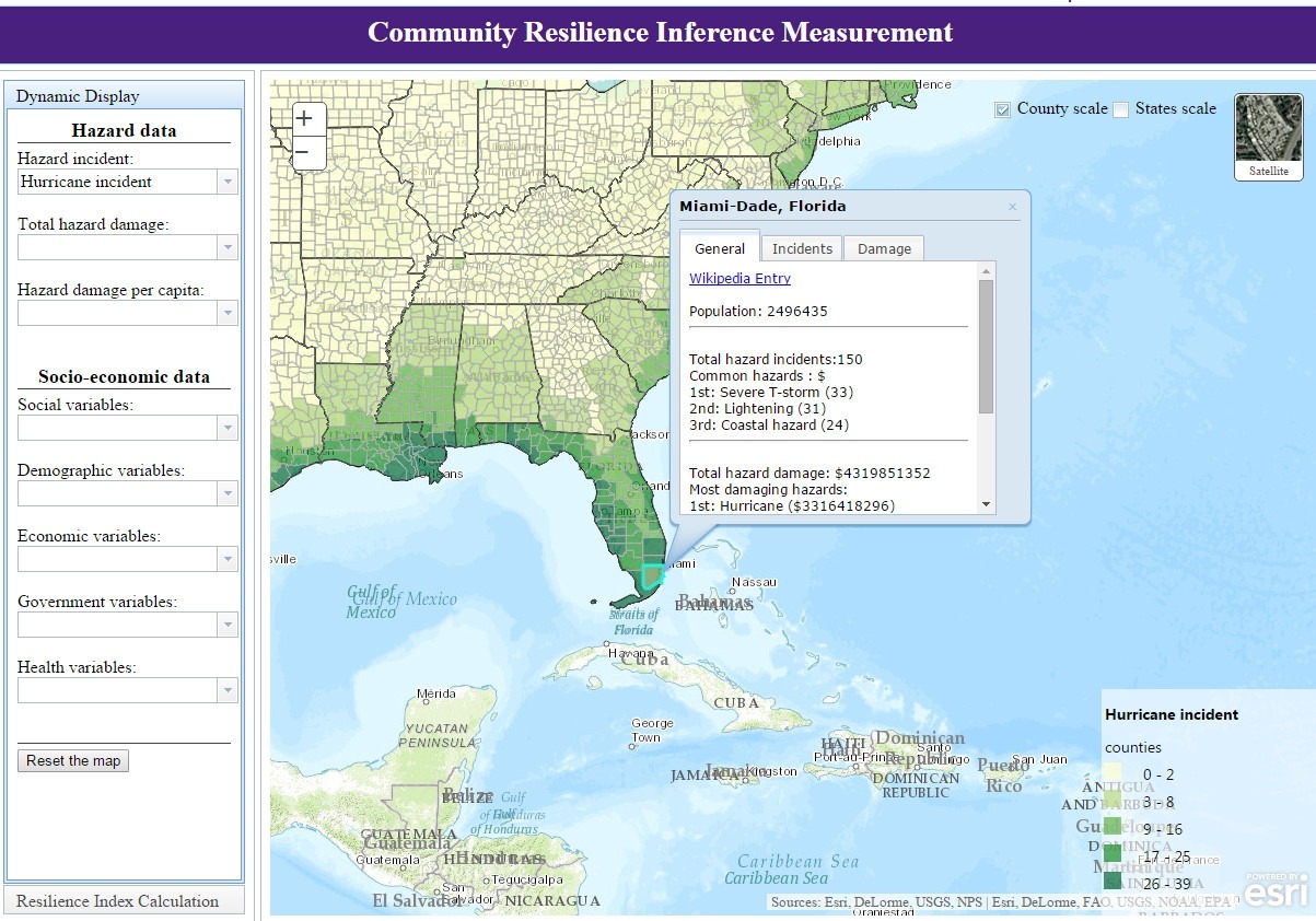
(1). Hazards Data:it’s obtained from SHELDUS (Spatial Hazard Event and Losses Database for the US) database developed by the Hazards & Vulnerability and Research Institute at the University of South Carolina, including eighteen categories of natural hazard;
(2). Socio-economic Data: 25 variables were collected from US Census, which is consisted of social, demographic, economic, governmental and health variables;
(3). Geospatial Data: the county-level shapefile was downloaded from USGS.
The application has three major functions:
(1) County-level and state-level access to the incidences and damages caused by different natural hazards, and 25 socio-economic factors in the United States;
(2) Dynamically measure the community resilience levels in an interactive approach at the county level;
(3) Identify regional socio-economic variables affecting community resilience.
Back