 |
Tsunami
warning system in the Pacific |
| |
The Tsunami Warning System (TWS) in the Pacific was
established in the middle of the last century after several tsunamis
hit coastal regions in the Pacific causing death and major damage.
The Pacific Tsunami Warning System (PTWS) is composed of 26 international
Member States that are organized as the International Coordination
Group for the Tsunami Warning System in the Pacific. The Group’s
functions include monitoring seismological and tidal stations throughout
the Pacific Basin to evaluate potential tsunami triggering earthquakes
and disseminating tsunami warning information.
Seismic stations are operated by most countries,
and in the USA by the following: the PTWC,
the West Coast / Alaska Tsunami
Warning Center (WC/ATWC), the U.S. Geological Survey's National
Earthquake Information Center.
If the location and magnitude of an earthquake meet the known criteria
for generation of a tsunami,
a tsunami warning is issued to warn of an imminent tsunami hazard.
Predicted tsunami arrival times for the coastal communities which
are located within the geographic area are calculated by the maximum
distance the tsunami could travel in a few hours. A ‘tsunami-watch’,
with further predicted tsunami arrival times, is issued for areas
defined by the distance the tsunami could travel in a subsequent
time period. Depending on the dimensions of the detected tsunami
the warning is extended to the entire Pacific Basin. The tsunami
warning is disseminated to appropriate emergency officials and
the general public by a variety of communication methods. Some
of these include the tsunami watch, warning and information bulletins
issued by PTWC and ATWC, which are distributed to local, state,
national and international users as well as to the media. These
users, in turn, disseminate the tsunami information to the public,
generally over commercial radio and television channels.
Additionally, the NOAA Weather Radio System, which is based on a large number
of VHF transmitter sites provides direct broadcast of tsunami information to
the public.
Urgent marine warnings and tsunami related information is broadcast to coastal
users over medium frequency (MF) and very high frequency (VHF) marine radios
by the US Coast Guard. Local authorities and emergency managers of the areas
under tsunami warning are responsible to execute the existing evacuation plans.
For further information on the PTWC please see NOAA’s site at: http://www.prh.noaa.gov/ptwc/aboutptwc.htm
|
| |
|
|
Hawaii tsunami
warning system |
| |
Hawaii is
mainly affected by distant tsunamis generated throughout the Pacific
Ocean. There have been only two destructive local tsunamis recorded
in the last 200 years.
The following elements are included in the Hawaiian system:
- Tsunami
awareness is part of the coastal Hawaiian culture. Training to enable
prompt response to tsunami warnings is conducted by local communities. These
include monthly siren drills/ exercises and Emergency Alert System (EAS) radio
and television broadcasts to educate the public in how to respond to emergencies
including coastal evacuations.
- Monitoring
seismic activity throughout the Pacific is undertaken
by the PTWC.
- Tsunami
hazard maps of the Hawaiian Islands identify areas
according to their risk-levels.
- Tsunami
forecast with modern data analysis techniques aims
to evacuate Hawaiian coastlines (200,000 to 300,000
residents and tourists) in
a minimum of three
hours prior to first wave arrival.
- Evacuation
plans are in place as a result of the coordinated
effort of the PTWC, Hawaii State and County Civil Defence
and the Hawaii
Police Department.
The evacuation
plans are well understood, coordinated and exercised between
the PTWC, the State, and the County. After PTWC issues
a tsunami watch
an initial “Prepare to
Evacuate” message is issued by the State. After PTWC issues
a tsunami warning, the Civil Defence authorities plan to commence
a coastal evacuation.
After discussion
among the four groups, a decision is made to evacuate. The county
administrators and the police then activate sirens and the EAS
as well as authorizing Civil
Air Patrol aircraft to fly over isolated coastal areas announcing
evacuation. Three-minute siren signals prompt the people to turn
on their radios, over
which the evacuation notice is broadcast and the population is
also requested to follow
the evacuation instructions (evacuation maps) in the telephone
book. Over 300 Sirens of various types are placed across the
Islands. Most of the sirens
are electronic,
omni directional and non-rotating; some have voice capacity.
|
| |
|
|
Japanese
tsunami warning system |
| |
Japan
is located near an active subduction zone experiencing many
earthquakes and tsunamis. Therefore, Japan has developed
one of the most extensive tsunami warning systems in the
Pacific, and worldwide.
The main observatory of the Japanese Meteorological Agency (JMA) is located in
Tokyo, and five regional observatories are responsible for issuing tsunami warnings.
Data is continuously collected using satellites and cellular communication. After
an earthquake occurs offshore, the observatories close to the epicentre will
issue tsunami bulletins and tsunami warnings are broadcast within 3 minutes.
The bulletins will go to the prefectures through the Local Automatic Data Editing
and Switching Systems (L-ADESS), which will send forecast results like tsunami
height to the main observatories. The main observatory will issue bulletins (warning,
watch or information bulletin) to other prefectures and alert other government
agencies through Central-ADESS. The Central Emergency Management Communication
Network (CEMCN) includes ministries and agencies at the national level which
contribute to disaster mitigation such as the Ministry of Construction, Tokyo
Electric Power or the Nippon Broadcasting Corporation. |
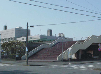
Stairs leading to a save place on a roof of a high building,
Japan. |
The following describes the local notification methods used in Japan:
- Simultaneous Announcement Wireless System (SAWS)
SAWS is a system of transmitters and receivers installed by local authorities
for all types of messages. Transmitters are located in the local government
offices and receivers are placed in hospitals, schools, fire stations, emergency
management offices and other locations. Some private individuals have also
bought receivers for their homes. Receiver towers with loudspeakers are installed
on streets and rooftops of prominent governmental or commercial buildings.
In cities, the effectiveness of SAWS is not always guaranteed because of occurrences
such as bad weather when people close their windows. A device, which may be
attached to telephones, can serve as a dedicated radio receiver -it will be
activated by a signal from the broadcast source and will turn on the loudspeaker
so that the SAWS message can then be heard.
- Mobile Announcer System
Fire-trucks equipped with loudspeakers cruise the areas which
are not covered by the SAWS.
- Television and Radio
A tsunami warning is given the priority to interrupt ongoing
programmes on both government and commercial television and
radio stations. The
message is
either a subtitle on the bottom of the screen, or, a window which
shows a map where the watch or warning applies; this is not
possible for
local tsunamis.
- Sirens and bells
In some villages, sirens are installed which prompt residents
to turn on their radio or television for further information.
Some villages
still stick to tradition
by clanging a bell to announce a tsunami warning.
- Telephone network and word of mouth
Some communities have created telephone networks but in some
cases the only way to reach people is by going from house
to house. Both
methods are time
consuming but necessary to reach populations that lack other
warning systems.
Local communities have extensive training allowing
them to respond automatically to tsunami warnings. Tsunami awareness
is such an intrinsic part of Japanese culture that after a high
level tsunami warning the majority of the at-risk population, even
if asleep, have evacuated to safe ground within five minutes!
For further information: http://www.jma.go.jp/JMA_HP/en/wave_j/ http://www.prh.noaa.gov/itic/library/pubs/online_docs/SP%2035%20Tsunami%20warning.pdf
|
| |
|
|
Links to (inter)national
tsunami warning systems |
| |
International:
National:
|
|