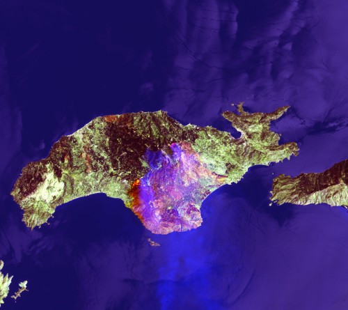
| Samos, Greece 2000 | ||
| Details: | JPG, 1756 x 1564 Pixel, 72 dpi | |
| Copyright: | European Space Agency (ESA) distributed by Eurimage | |
 |
|
On Thursday 6 July 2000, a fire started to burn large part of the Aegean Sea island of Samos.
Many fires started on this week in Greece due to the high temperatures (up to 40° C), but Samos is the scene of the largest fire in the country. The state of emergency was decleared on Thursday: homes were evacuated as about 450 firefighters, soldiers and hundreds of civilian volunteers tried to bring the blaze under control. Six airplanes, four helicopters, 40 fire trucks and 15 water tankers were deployed to battle the blaze, authorities said. Although the extent of the damage was not known, several abandoned homes, hundreds of acres of farm land and forest had been reportedly destroyed. Though Greece received some heat relief, strong, dry winds fueled more than 100 forest and brush fires in the country. The image was acquired on Sunday 9 July by the Landsat 7 satellite (trk 181). The image is a Landsat 7 752 band combination. With this combination the active fires are very evident in Yellow - Orange (green-yellow is the hottest part). The smoke of the fire is visible in blue while the burnt areas in brown. |