| Yangtze, China 1998 | ||
| Details: | JPG, 1448 x 1387 Pixel, 72 dpi | |
| Copyright: | European Space Agency (ESA) | |
 |
|
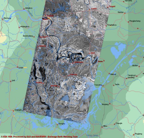
This ERS-2 SAR image, centerd around Huarong (200 km Southwest of Wuhan) and the Yangtze River, was acquired by the station of Ulan Bator (Mongolia) on the 1st of August 1998.
The areas in black are the one covered by water during the satellite pass. To detect easily the flooded area respect the normal rivers flow we have superimposed a semi-transparent layer with the rivers in light blue. The portion covered by water of the area near Huarong after the above mentioned dikes (at the right edge near the mid-bottom of the SAR image) is more than doubled. |