| Dessau, Germany, August 2002 | ||
| Details: | JPG, 2126 x 2126 Pixel, 300 dpi | |
| Copyright: | European Space Imaging (EUSI) http://www.Euspaceimaging.com | |
 |
|
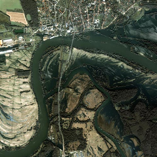
This one-meter resolution satellite image was collected by Space Imaging's IKONOS satellite on Aug. 21, 2002. The image shows extensive flooding in eastern Germany where the Mulde River joins the Elbe River just north of Dessau, Germany. According to reports, the two-week-long flooding was the worst Europe had seen in 150 years. Standing water surrounding the flooded riverbanks has engulfed trees along the shoreline. Imagery collected after severe flooding could be used to assess damage to man-made and natural features. During a flood, emergency response agencies can use map-accurate imagery to plan evacuations, recovery operations and establish victim relief centers. Credit "Space Imaging."
|